Marstow Maps
Marstow parish lies in the south of the county and has undergone significant boundary changes since the 1838 tithe map was drawn up. The area of the historic parish coincided just about with a detached part of the manor of Wilton on Wye, called Little Wilton or Wilton Parva.
Part of the current parish was ex-monastic land extra-parochial at the time of the tithe map, comprising a small estate called New Court situated in a loop of the Garron river. The 1884 plan of the Newcourt estate was made when the part enclosed by a loop of the river Garron was still extra-parochial, having been granted to Monmouth Priory soon after 1100. See TWNFC, 2007, Villa Cachebren, pages 112-9, downloadable here.
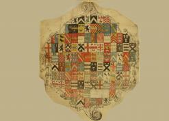
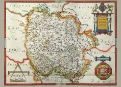
The boundaries between Goodrich and Marstow were rationalised in the 18th/19th centuries. At the time of an estate terrier and map of Little Ash in 1761 the area was in Goodrich. It has a fine map see Little Ash Estate with terrier .
