ONLINE MAP SOURCES
ONLINE MAP SOURCES
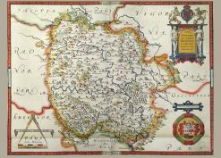
There are a number of online sources which allow you to view maps in high quality and/or to download them. Some require persistence in finding the Herefordshire map for the area you want. For example, in the OS maps published in the 1810s Herefordshire's boundary areas are included in other maps such as Newent. New sources are coming online all the time.
General Sources
The British Library has published a number of maps online but it is not always easy to find what there is as they are catalogued in a non-intuitive way often relative to an exhibition - as here. For this reason some direct links are given below. You might be interested in their geo-referencing project where members of the public are mapping images from the library's old books onto current maps.
The National Library of Scotland has made a number of English and Welsh maps available online. There is an interactive graphical search mechanism where you choose your county and maybe a parish or a square on the map, and the available maps are shown. See what it looks like here. when you choose a map (and after passing the copyright notice) the map seems blurry, but zoom with the + sign and after a few seconds the map will be clear. Some 25" to the mile maps are available. Alternatively you can scroll down the list of available map sources to the OS maps for England, choose the first option of separate sheets and put the grid reference in and press 'Go'. This will take you to the exact OS shett. Otherwise pt in a place name but you may have to look at contiguous sheets to find the place you want.
The Vision of Britain website is worth browsing for a variety of maps. Old Maps online is a commercial site which links to other websites which have images of maps when you select your area of the map overall . (Not all maps illustrated are still available) You can choose a particular map and zoom it. Some redirect you to the British Library site but others are in Europe, and some allow you to copy a zoomed-up section.
The Herefordshire History website also gives access to detailed images of a number of maps, but you can't download them without charge.
See below for specific Herefordshire maps on these sites.
First Edition OS maps
The British Library website has a fully zoomable set of these maps. For areas at the county borders you have to pick a likely section.
British Library 1st ed OS 1” to mile Hereford 1815 Thomas Budgen
British Library 1st ed OS 1” to mile Bromyard 1816
British Library 1st ed OS 1” to mile Weobley 1814 Thomas Budgen
British Library 1st ed OS 1” to mile Usk 1813 Charles Budgen
British Library 1st ed OS 1” to mile Hay 1814 Budgen
British Library 1st ed OS 1” to mile Presteigne 1815 Thomas Budgen
British Library 1st ed OS 1” to mile Cleobury Mortimer 1817 Henry Stevens
British Library 1st ed OS 1” to mile Bishop’s Castle 1816 Thomas Budgen
British Library 1st ed OS 1” to mile Malvern 1812 Robert Dawson
British Library 1st ed OS 1” to mile Newent 1811 Robert Dawson
