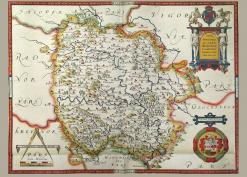
Rowlestone is a thinly-inhabited parish in the west of Herefordshire, just inside the English-Welsh border.
1790 (approx) map of the Rowlestone Park estate can be found in the Kentchurch Court archives.The map shows numbered fields and woodland but no field names. (Photo: David Lovelace)
1790 (approx) map of the Rowlestone Court estate can be found in the Kentchurch Court archives. The map shows numbered fields and woodland but no field names. There is a plan of the Court gardens. (Photo: David Lovelace)
1790 (approx) map of The Bithell estate can be found in the Kentchurch Court archives. The map shows numbered fields and woodland but no field names. (Photo: David Lovelace)
