Mathon is a small village lying to the east of Herefordshire about equidistant between Ledbury to the south and Bromyard to the north-west.
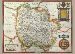
1628: a survey map of Malvern Chase shows land mainly in Worcestershire but there are a few small parts in Herefordshire along the western boundary. A separate sheet with the details of the Herefordshire parcels has been digitally attached to the map for information. Also, an article on the 1628 survey and transcription of all the entries can be found here. (Map photos courtesy of David Lovelace)
In 1780 the surveyor J. Aird drew a decorative estate map for Edward Holder and his wife Ann, an estate which Edward held in right of his wife. The estate covered parts of the parishes of Colwall, Cradley and Mathon. On the map details of the different plots are given and a transcription of these has been made. The map is held by Herefordshire Archives and Record Centre with the reference B9/6. (Thanks to David Lovelace for the photography and assembly of this large map).
