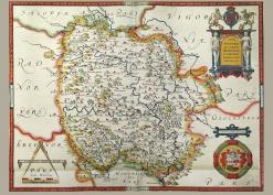
Kentchurch is a small village in the far south-west of Herefordshire, about 21km south-west of Hereford and 21km north-east of Abergavenny. It lies next to the river Monnow marking the England-Wales boundary.
1790 approx Bannut Tree map showing field boundaries some trees, building outline and tracks. Neither owner nor occupier given. (Photo: David Lovelace)
1790 approx Crabs Castle. Field numbers, boundaries, usage , direction of furrows. (Photo: David Lovelace)
